

It's not exactly a triangle on the map, but I imagined it as a triangle when I was plotting it out in my mind. This, my friends, is a 60 mile ride that I realized I could do from my house. The triangle is made up of three legs: 16 miles from my house to Lorton, 22 miles from Lorton to Old Town, 22 miles from Old Town to home. It makes a 60 mile loop that is almost entirely on bike paths. Woot!
And there are even some good places to stop: Mount Vernon has public bathrooms and snacks for sale, Old Town has restaurants, and the W&OD passes by the new Vienna rec center on my last leg before home.
This route became a possibility when the missing link was completed this past year between Lorton and Mount Vernon. Laurie brought the completed Lorton bike paths to my attention this fall because this is where she mostly rides. I rode the Lorton leg with her after we got back from France--deets here. In fact, that is the ride that did in her knee. Sorry about that Laurie!
I started out from home and rode to Mason then down 123 all the way to Lorton Road. This was 16 miles.
 |
| Passing the Fairfax County Parkway sign |
 |
| The empty bike trail along 123. Nobody was out on this day. |
When I hit Lorton Road on 123, I turned left and took Lorton Road all the way to Rte 1.
 |
| Crossing Hoos Road, heading down Lorton Road |
 |
| About to pass under 95 south on Lorton Road |
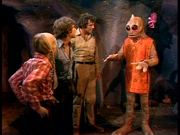 |
| See the Sleestack's three-fingered hand? That's me on the bike in my gloves. |
They work great, but taking pictures in them is impossible. I couldn't even get my phone out of my bag while wearing them!
 |
| Waiting at the light to turn onto Rt. 1. I was trying to get a picture of the hill rising off to the left, but the picture doesn't do it justice at all. |
 |
| Approaching Mt. Vernon on the Mt. Vernon Pkway |
At this point I'd gone 26 miles and the whole day felt very possible and fun.
 |
| Walkway at Mt. Vernon down to my "shelter" next to the bathrooms |
 |
| Sheep in the field at Mt. Vernon. It was a beautiful day. But can you see the cold? |
 |
| Tables where Katie, Lisa, and Deb and I stopped so many years ago on our trip to D.C. - see below! |
 |
| We were so hot. I remember those red gatorades being cold and awesome! More on that trip here. |

It was not hot on this day. Not a soul was outside when I passed through this time. I was freezing just taking the time to snap this pic.
 |
| The GW parkway trail. |
This was a problem because I was supposed to connect with Steve in Old Town and potentially ride home with him in the car if I didn't feel like riding the last 22 miles. I wanted to ride through, but I had no way of letting Steve know. Stopping by his office would have added at least 30 minutes to my ride, which would put me home after dark. Now I had to get home quickly (by 5pm) so Steve wouldn't be worrying and wondering why he hadn't heard from me.
When I arrived at the end of the W&OD, I decided I had to stop for something to eat. For a 60 mile ride I would usually stop and eat several times--look at how much I ate at the Great Pumpkin Ride! But now I was at mile 41 and all I'd eaten was a PB&J. So I parked my bike and paced around while trying to quickly chew almonds and dried fruit. My mouth was suddenly so dry--I realized I'd hardly drank anything either. It was just too hard (and unappealing) in the cold.
So I forced myself to drink a bunch of water to wash down the last mouthful of trail mix then I hopped back on my bike for the final push home.
This last leg of the ride was the hardest. I have no pictures because my phone had died, but I doubt I would have stopped to take pictures anyway. I truly began to be cold now. I was riding up on the W&OD and into the wind. By the time I arrived in Vienna, my legs and feet felt like frozen blocks. If Steve had showed up with the car, I think I would have jumped in.
Seven miles later, I was home. 13.1 mph - super slow, but it's all the steam I had coming home. My avg was over 15 mph at Mount Vernon but that was before I got cold and after a lot of downhill. Coming home into the wind took everything out of me.
It took some time to warm up. I first paced around in all my bike clothes in the house. Then I drew a bath and eased myself in. I stayed in there until I was sweaty and pruny. Nice end to the ride.
Distance: 60 miles
Speed: 13.1 mph
So I forced myself to drink a bunch of water to wash down the last mouthful of trail mix then I hopped back on my bike for the final push home.
 |
| Elevation chart of the ride. You can see the big drop at Lorton Road and then the steady invisible incline that is the W&OD. The ride along the Potomac is in the middle, of course. |
This last leg of the ride was the hardest. I have no pictures because my phone had died, but I doubt I would have stopped to take pictures anyway. I truly began to be cold now. I was riding up on the W&OD and into the wind. By the time I arrived in Vienna, my legs and feet felt like frozen blocks. If Steve had showed up with the car, I think I would have jumped in.
Seven miles later, I was home. 13.1 mph - super slow, but it's all the steam I had coming home. My avg was over 15 mph at Mount Vernon but that was before I got cold and after a lot of downhill. Coming home into the wind took everything out of me.
It took some time to warm up. I first paced around in all my bike clothes in the house. Then I drew a bath and eased myself in. I stayed in there until I was sweaty and pruny. Nice end to the ride.
Speed: 13.1 mph